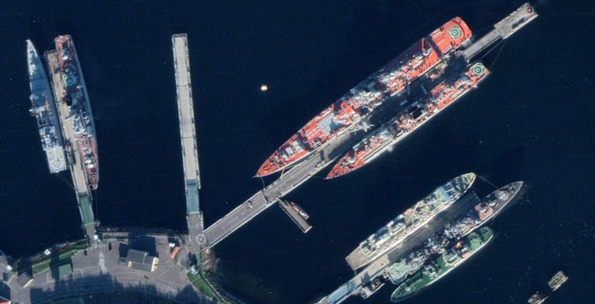
Now a variety of intercontinental ballistic missile launchers, command posts, secret ranges and more can be seen with a resolution of about 0.5 meters per pixel. Until now, they were displayed at times in worse quality, which did not allow to disassemble and examine all the details.
Recently, with the beginning of the large-scale Russian invasion of Ukraine, Google shows all the strategic objects of Russia and its powerful army.
In the Google Maps service, all military and strategic objects of the Russian Federation became available in maximum resolution. Now a variety of intercontinental ballistic missile launchers, command posts, secret ranges and more can be seen with a resolution of about 0.5 meters per pixel. Until now, they were displayed at times in worse quality, which did not allow to disassemble and examine all the details.

Enjoyed the post
Thanks for the post
Good read
Another good post
Enjoyed the read